Sunday, April 29, 2007

State Trust Land

Below is a photo of the beautiful spot we had to vacate yesterday. We were parked with some friends in this valley just south of Moab that we knew was used by RVers frequently. We all thought this was federal land managed by the Bureau of Land Management and perfectly legal for us to spend some time there, as we all had done in the past. Well we were visited one morning by an employee of the State of Utah who informed us we needed to move off of State Trust Land within the next day. Needless to say, we were very disappointed. Didn't they understand that we were doing no harm? After all, the cows and horses were trampling on the ground and eating everything there. After some growsing amongst ourselves, we decided that at least we would make further inquiries and explain to the appropriate individuals that we were very good custodians of the land and that perhaps they would see fit to let us stay.
Well we wrote a letter to the State of Utah Land Trust Dept. and the six of us went to the office in Moab to discuss this with the young man who had come to give us our notice that morning. It was a learning experience. He was very respectful of our situation and listened courteously to our lobbying efforts. We learned that the land was donated for the sole purpose of earning funds to be contributed to the schools in Utah. The Land Trust Dept. is responsible for insuring the value of the land is maintained. The grazing of cows and horses that is permitted on the land helps to raise funds. It was difficult to argue with the ban on camping on the land after we were more informed. Due to our persuasive manners, we were successful in getting permission to stay for a few more days. But after sleeping on it, we all packed up and moved to the BLM campground a couple of miles down the road the next morning. We still have a fantastic view, just not the wide open space that we were sharing with the cows.
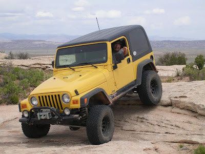
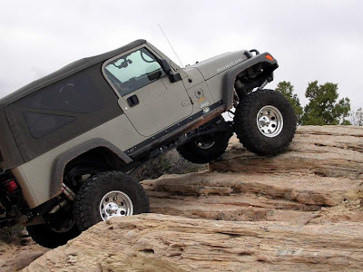
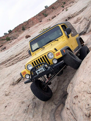
Our off-roading is in full swing now with friends that we met last year in Moab. Today we took the "Steelbender" trail. It was a full day of fourwheeling, about seven hours. There were plenty of obstacles and challenges. Photos of this weeks trails will follow.

Friday, April 27, 2007

Nature's Creations

We spent a day getting closer to some of the wonders nature has created in the Arches National Park. It was definitely an interesting episode. We saw people hiking and climbing everywhere, all sizes and ages and nationalities of people. The uniquely shaped formations in this park seem to demand that they be climbed. Parents climb with children, photographing them at every juncture. We even came across these climbers who brought their mountain climbing gear. The fellow at the bottom kept calling to the girl on the top in what sounded like French and she kept raising her arms for photos.


There are more natural arches here than anywhere in the world. One of the most popular to see in the park is Landscape Arch. It is over 300 feet long. About 15 years ago a slab of rock about 60 feet long and 4 feet thick fell from the underside so no one is allowed to walk beneath it any more. Here is a photo of that arch. Who knows how long it will last due to its very thin structure. The hike to see Landscape Arch is 1.5 miles and the trail continues beyond it to other arches. On the day we chose to be there a hiker broke her ankle while at the furthest point of the trail and had to be helicoptered out. Nature can be dangerous.


The arches were created over 100 million years by underground salt movement, extreme temperatures and erosion by water and ice. The picture here shows some of the "fins" created by pressure forcing rock layers upward. This natural passageway is actually a part of the trail leading to an arch called Sandstone Arch. It's in the middle of a group of these fins and children were having lots of fun using it like a playground.


It rained for a couple of days and afterwards the flowers in the park were blooming everywhere. I don't know what these beautiful deep crimson blooms are but they dot the sandy hills throughout the park.

And here's a prickly cactus sprouting its first brilliant bloom with many others just ready to burst. These are examples of the many purples, oranges, reds and yellows decorating the landscape.


Our stay in Arches National Park is over, but we've moved only about 30 miles away, south of Moab. For now we are boondocking in a beautiful valley with a few RVer friends and some cattle. Looks like we won't be here too much longer though since we had a visit from the State of Utah Trust Land Dept. telling us we need to move on. It's one of those "long stories" that will be told another time. But we will find a place close by. To be continued.


Monday, April 23, 2007

Arches and Mashed Potatoes

Our latest roost is in the beautiful Arches National Park in Moab, Utah. Our friends, Jack and Danielle, are volunteer camp hosts here and helped us select the most gorgeous spot of all (#21) in the Devil's Garden campground.
This photo is our view of La Sal Mountain and the natural splendor of the park. It's been cloudy and rainy today but this evening after the rain stopped we had a stunning display when the sun came through the clouds causing many shifting and changing colors on the sandstone in our backyard and the distant mountains.


Yesterday we went off-roading with Danielle and Jack and another couple we like being with, Jan and Geir, whom we met in Moab last year. Knowing they would never steer us wrong, when Geir and Jan kindly offered to take us on a trail called "Mashed Potatoes," we all quickly accepted. It was a great time!
Early in our afternoon's adventure they took us to a very interesting spot where two pieces of mountain have laid against each other somehow, forming a v-shape. Here's a photo of a few of our group entering one side. This opening is about 50 yards long and shows traces of mountain lions inside, seeming to be a perfect shelter for any animal. We all walked from one end to the other. The next photo is Jerry, Jack, Danielle, Geir and Jan at the other end of the tunnel/mountain.


The next several hours on Mashed Potatoes trail was packed with 4wheeling fun. This area is an array of the petrified sand dunes that could for sure be described as mounds of those yummy potatoes.


Here's a few photos showing the enjoyment we all had in this playground.


Geir showing us how their "Rubi" does its tricks on rocks.


Below Jack and Jerry each pick their own routes, while Danielle gets the best vantage point for a photo.


The last photo on the page is Jerry taking an "extra credit" challenge. This crevice is a favorite spot for anybody wanting to add a little excitement to the trail. You have to be careful not to get a tire in the wrong place and slide sideways into the crack. Geir gave Jerry some great spotting on this one and he had a ball.

There are more photos of today's escapade posted on our photo site. If you would like to see them, click on Utah 2007 in the right column of our blog. When you are on the image page, click Utah 2007 again and then click the Moab file.

Saturday, April 21, 2007

Valley of the Gods and the Devil's Ascent


On our last day in the Mexican Hat, Utah, area we planned to explore a little more and that we did!

First on the list, was Valley of the Gods. We heard from a fellow traveler how much they enjoyed it. We were very impressed. In fact, our opinion is that the landscape is twice as beautiful as Monument Valley. These 250,000,000 year old sandstone rock formations surround you as you drive through the valley.


The Navajo believe that the monoliths are spirits of warriors that give strength and power to soldiers as they go to war. As we stopped in a solitary spot for lunch, the wind started howling and stirred up quite a haze that eerily clouded the scene. Was there a message?


The erosion from the wind, water and ice have formed endless interesting shapes. Many of the huge rocks seem to be teetering on the top, waiting to fall any moment, just suspended.


Some of nature's artwork in the valley have acquired names based on their resemblances, such as, the Hen on Nest and the Seven Sailors. Our favorite was the balancing rock named, "Lady in the Tub." Can you see her below with her back to you and her knee just poking up through the bubbles?


It was still early afternoon when we finished our drive through the Valley of the Gods and Jerry suggested we take a ride up the road a ways. He was curious about the signs we had read at the entrance to this highway a few days ago.

Well the sign was the type we've all read and taken with a grain of salt. You know, one that reads something like, slow, 10 mph curves, etc. We've all seen them and the road turned out to be perfectly safe at something like 30 mph. Well, this one turned out to be "the road from hell." It was three miles of very steep, loose, slippery gravel -- winding and narrow with no shoulder -- up the side of this mountain. Did we mention the wind too?? Well we were both sooo glad to be at the top. This one we are naming: The Devil's Ascent. It was horrendous!


This photo can't do it justice but it gives just a hint at the experience. It was taken as we slowed momentarily behind some crazy people who were
actually getting out of their car to snap photos.

So Nancy snapped a quick one out the window. Notice the gravel at the front of the photo. That's how the edge looked all the way up.


So anyway, by the top we were both determined that regardless of how far it was to go around, we sure weren't going back down. Luckily we brought our topographical map and found a county road that took us only about 40 miles around and back to our little home. As this part of the tale turned out it was fortunate that we have a Jeep because this county road was muddy, full of large boulders and contained some areas unfit for regular vehicles. Two hours later we came back to the highway leading to our rig just in time for the wind to have increased to 50-60 mph. After fighting our way out of the Jeep and into the motorhome only to feel it rocking to and fro, we concluded that we had better move back from our canyon view until the gale force winds subsided. We put Ferd in reverse for about 50 feet and waited out the wind. This one was a day for the memory bank!

Sunday, April 15, 2007

Utah's Monument Valley

Here we are in southeastern Utah at Goose Necks State Park, just north of Mexican Hat, Utah. What a find! This park is merely a level area next to a 1,000 foot deep canyon where people come to gaze for a while at this etching of nature. We are so fortunate to be spending a few days instead of a few moments at the edge of this beautiful view.

Have you ever heard of an entrenched meander? This is what happens when a river that winds its way across a plateau for thousands
of years becomes entrenched due to the uplifting of the plateau by forces beneath the earth and the erosion of the water. As the San Juan River meandered across the Colorado Plateau it became this 1,000 foot deep canyon and continues to erode its way each day.

This photo is the view from the front window of our rig of this entrenched meander. It's spectacular, free and private at night so far!

The San Juan River feeds into the Colorado River in western Utah. We saw some rafters floating the river as we drove through Mexican Hat, about 20 miles southeast of us, and then saw them again slowly drifting down our section of the river the next day. Would have been quite a sight from down there at their vantage point as well.


We came up this highway to see Monument Valley, the area famous for the buttes, mesas and sandstone formations appearing in many old Western movies such as "How the West Was Won" and even in a newer movie, "Back to the Future III." It was another of those "Wow" situations as we drove north on Highway 163 and began seeing these "monuments" that seem to be sculpted at intervals in the landscape.


Monument Valley is situated on a Navajo Indian Reservation and the Tribal Park is open to visitors. We took the 17 mile Valley Loop in our Jeep, soaking up the many shapes and colors of the various formations.


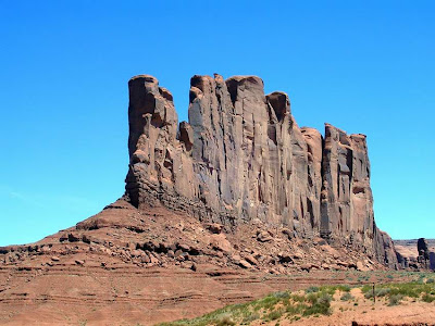
Camel Butte was a favorite. Can you see the big camel in the photo? Some of the formations looked like sculptures, as though an artist had sliced off or scooped out hunks of clay.


It's one of those places where you keep seeing one photo op after another. If you would like to see more, click on the Utah 2007 photo link in the right column. There are even two short video clips, one of the panoramic scene at our site and one of the view from the visitor's center at Monument Valley.


We will be staying here a few days to take advantage of the surroundings. Our best to everyone who may be going through the bad weather we've been hearing about in the midwest and east. There are high winds here today, around 40 mph, but we're hanging on.

Thursday, April 12, 2007

Moving North

Good ole Sol is warming up this area of Arizona and
the spring migration of RVers can be observed moving north to a more comfortable climate.


Over the last few days this phenomenon could be witnessed from our motorhome between 9:00 and 11:00 a.m. One after the other, Escapees members exited the Casa Grande Park,


leaving empty lots all in a row with their seemingly lonely, yet colorful, storage units waiting patiently for owners to return in the fall.

The sightings of rattle snakes in the park this week may also give some impetus to the movement north.


As we took our evening walk last night this scene struck me as a mix of current and classic technology. This "Boomer" has preserved a classic means of transportation as his home while employing solar energy on the roof and an internet satellite for communication. Nice!!


We also will be pulling out of the park tomorrow. Our plans are to travel to Monument Valley on the border of Arizona and Utah. Depending on the condition of Jerry's aching back at that point, we will either head for Indianapolis and doctor evaluations or continue north to Moab for 4wheeling. Our decisions will be day-to-day as we evaluate his comfort level. For now we are looking forward to more super scenery in the next few days. When we have an internet connection again there will be posts on our blog. Stay tuned!!!

Saturday, April 7, 2007

Cruising up to Casa Grande


We left our two and four-legged friends in McNeal, Arizona, last Sunday to travel a little ways north, through Benson for a few days stop at the Escapees Park, then on for a brief stop of a few hours in Tucson and on up to Casa Grande where we have been hanging out at the Rovers Roost Escapees Park. We are here to keep an appointment for more modifications on Ole Yeller - a little help for the underbelly when we bump along the trails. As always happens in Escapees parks, we found friendly neighbors. Here Jerry relaxes in the shade for what is surely an important and meaningful conversation with a new friend, Ken Hrychyk. Ken and wife Deb are from Alberta, Canada, returning from their six month stay in Mexico.